


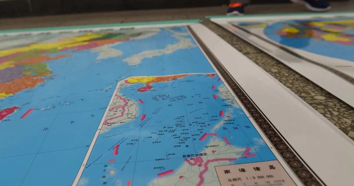
China’s dashed-line map illustrates the effect. In May 2009 (Opens in new window), Beijing attached the map to diplomatic notes responding to continental-shelf submissions by Malaysia and Vietnam. The text asserted sovereignty over islands and adjacent waters, along with sovereign rights and jurisdiction over relevant waters, seabed, and subsoil. It did not explain exactly what legal effect China attributed to the dashes.
The image nevertheless enclosed most of the South China Sea within a single broken line. The accompanying wording left the scope of China’s claim open to interpretation, while the map offered no sign that other governments also claimed much of the same space.
China also regulates how maps intended for public release depict its territory. Such maps generally must undergo official review (Opens in new window), and approved maps carry an official review number. Maps that omit or alter the approved territorial depiction are illegal. The Ministry of Natural Resources has also established an annual publicity week (Opens in new window) to promote national-territory awareness, extending the approved depiction beyond map regulation and into public education.
That official picture contrasts with the legal distinctions drawn by the 2016 arbitral award (Opens in new window). The tribunal did not decide sovereignty over land features or delimit a maritime boundary. It addressed the legal basis of historic rights, maritime entitlements, and the status of particular features. China rejected the proceedings and the outcome.
Those legal distinctions did not remove Chinese ships or end confrontations at sea. A decade later, Chinese and Philippine personnel were still clashing near Second Thomas Shoal. The award clarified the law, but it did not dislodge the territorial picture Beijing had built around its claim.
Repeated official depiction can create a political constraint of its own. When a government consistently presents contested space as national territory, compromise becomes harder to explain at home. The dispute can then appear to concern not only legal rights or access, but whether the state is giving up territory it has long depicted as its own.
That pressure may encourage officials to restate the claim more forcefully, making later accommodation harder. This dynamic is not unique to China. The Philippines, for example, requires official maps and charts to use the West Philippine Sea designation (Opens in new window) and has moved to include the issue in the grade-school curriculum (Opens in new window). The legal merits of the competing claims differ, but both governments use official depictions and public education to reinforce how their citizens understand the dispute.
A map cannot settle a dispute or enforce a claim on its own. Its influence comes from how governments embed it in diplomacy, administration, and public education. Once a contested claim becomes part of the national map, any effort to manage or adjust that claim must also contend with domestic expectations the government helped create.
The views expressed are those of the author and do not reflect the official position of the US Department of Defense or the US Government.












Leave a comment