


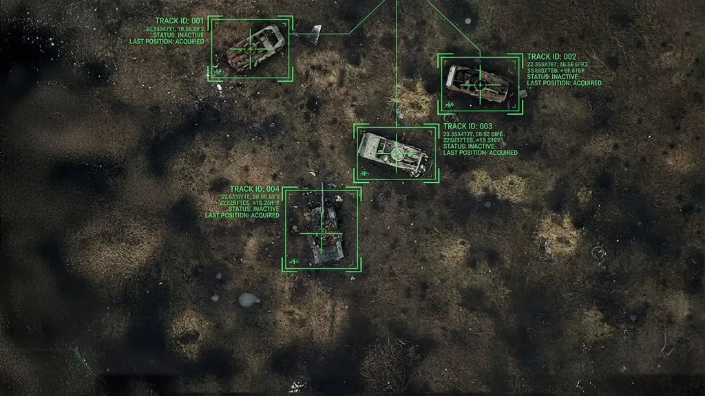
Battlefield data shared between allies for model training needs to be graded for quality, just as oil is.
The war in Ukraine is transforming battlefield data into a shareable asset. In August, Britain became the first foreign country to get access to Ukraine’s Avengers AI Labs, a platform collecting data from thousands of cameras and infrared sensors. The British government has described the platform as a gold mine.
Meanwhile, the Iran war is demonstrating that the asset lacks a grade. The conflict has been fought within a data environment that is unreliable at the point of generation. In the first four days of the war alone, 1,735 instances of satellite-navigation interference were recorded across the Gulf. In the same period, Iranian drones damaged data centres in the United Arab Emirates and Bahrain, forcing a break in data custody.
Battlefield data now has volume and a price but no assay: nothing certifies what fraction of a dataset was induced by deceptive signals (spoofing), degraded by the defender’s own jamming, reset or restored under duress, or absent because an interceptor was autonomous. A clean thermal frame of a Shahed strike drone with a corrupted range label looks fine, but it is a compromised training example.
Training on such data is fraught with risk. Imagine a counter-drone software model trained on Gulf footage whose range labels were shifted by spoofing: it would learn that an incoming Shahed is farther away than it is, launch its interceptor late and let the drone through.
Within a week, the Iran war produced the largest concentration of satellite-navigation interference yet documented in a maritime theatre. This resulted in, for example, cargo vessels falsely positioned at airports, at a nuclear power plant and elsewhere on land. The marine insurer Skuld advised that satellite-navigation interference had become ‘a persistent operating condition’. Aircraft experienced similar problems: the information-sharing aviation network Opsgroup reported that flights were losing GPS entirely while arriving at and departing from Gulf airports, and that air traffic control was routinely substituting runway-heading departures and radar vectors for satellite-based navigation.
There have been warnings about GPS interference in the Gulf since 2019, and Iran demonstrated its capability at national scale during anti-government protests before the war. However, such interference is frequently a countermeasure performed by defenders and designed to confuse incoming munitions. Since October 2023, Israel’s military has admitted to disrupting navigation signals, an activity that is interpreted by experts as fooling GPS receivers for hundreds of kilometres. This suggests the defensive share of the distorted electromagnetic environment was significant.
Jamming and spoofing corrupt positions and timing, not pixels, but datasets of imagery are still damaged, because multi-sensor fusion depends on timing derived from navigation satellites. In the fusion process, radar, electro-optical, infrared and radio-frequency tracks are aligned by a common time reference. When timing degrades, alignment between otherwise clean sensor streams drifts, and the fused record inherits the error. The imagery survives; the metadata does not.
While this first layer of interference in the Gulf was electromagnetic, a second layer was physical. Iran attacked at least three data centres in the UAE and Bahrain. So the data was attacked where it was recorded. It may have been moved when under fire. A record that has been relocated, switched to a backup site and restored under attack cannot be attested with confidence. Even if all of it survives, provenance becomes doubtful.
The more our defences depend on autonomy to survive electromagnetic warfare, the less the engagement is recorded. The US Army sent to the Middle East about 10,000 Merops interceptor drones, which can prosecute targets autonomously. But whereas a conventional air-defence engagement leaves a trail of data with the fire-control system on the ground, an autonomous interceptor operating without a live link is not sending information back. The record depends on what the airframe retains, if it is recovered at all (and an interceptor that hits cannot be).
Gulf battlefield data is therefore contested-provenance data, generated under conditions in which parts of the observable environment can credibly be assessed to have been manipulated, corrupted or, because of autonomy, missing. The same is true of Ukraine, where the Avengers datasets are visual and thermal pictures of aerial targets whose pixels look clean. However, Russia regularly launches decoy drones alongside Shaheds, which are built to look like them on sensors. Ukraine’s own defensive jamming is pervasive. And neither the jamming state nor the decoy ratio travels with the frames that Britain has now acquired.
The remedy can be an international, technical effort in the form of an assay: a Contested Provenance Standard for battlefield datasets. Just as a crude assay identifies what a cargo certificate must state, the standard would specify what a battlefield dataset must contain to be assayable. This should include presentation fields, which track the decoy assessment for the field of view and the engagement’s wave structure (single, salvo, attritional), and environment fields covering active friendly emitters, bands, power, duration, known or suspected adversary interference and satellite-navigation integrity as assessed by the recording platform.
Countries in the Gulf hold, and Ukraine sells, datasets whose contamination is neither measured nor disclosed. An assay standard is urgently needed for the data that has become integral to the defence of the Gulf and of the West, in wars which increasingly intersect.












Leave a comment